|
|
yang lenlain gambar tak kluar ke???
Apsal sut bleh nampak gambar nya!!!!
Originally posted by fatz at 28-5-2006 10:19 PM
apasal posting 136 jer yg boleh nampak gambar?.... |
|
|
|
|
|
|
|
|
|
|
|
Originally posted by Browneyes at 26-5-2006 04:12 PM
singpost punya eh?...
donno.. V dah pack utk pindah dah sumer poskad tu...  |
|
|
|
|
|
|
|
|
|
|
|
Originally posted by fatz at 28-5-2006 10:19 PM
apasal posting 136 jer yg boleh nampak gambar?....
cu, nek bleh nampak ah.... |
|
|
|
|
|
|
|
|
|
|
|
Originally posted by sutera_abadi at 28-5-2006 10:21 PM
yang lenlain gambar tak kluar ke???
Apsal sut bleh nampak gambar nya!!!!
ak ah la sut...dep punya gambar semua no problem
dah klik 'show picture' pun tak leh nampak jugak... |
|
|
|
|
|
|
|
|
|
|
|
Originally posted by virgomal at 28-5-2006 10:25 PM
cu, nek bleh nampak ah....
cu masih tak bleh nampak la nek....
heh...apa nak buat, kekurangan diri dah jangkit kat pc agaknya :cry: |
|
|
|
|
|
|
|
|
|
|
|
Originally posted by fatz at 28-5-2006 10:28 PM
cu masih tak bleh nampak la nek....
heh...apa nak buat, kekurangan diri dah jangkit kat pc agaknya :cry:
wakakaka..
nenek copy properties pastu tgk kat window lain...
tu pasal bleh nampak :nerd: |
|
|
|
|
|
|
|
|
|
|
|
Originally posted by virgomal at 28-5-2006 10:29 PM
wakakaka..
nenek copy properties pastu tgk kat window lain...
tu pasal bleh nampak :nerd:
ok ok...dah bleh nampak dah ni nek...tengkiu...
leceh tul arr... |
|
|
|
|
|
|
|
|
|
|
|
S I N G A P O R E W A T E R F R O N T , 1 9 6 0 ' s - A E R I A L V I E W

This is an excellent archival postcard of Singapore's historic waterfront, ca. 1960. From bottom left to right: Clifford Pier, Collyer Quay, and the Fullerton Building. The blacktop road running left to right across the postcard represents where Singapore's old, early 20th century waterfront existed |
Rate
-
1
View Rating Log
-
|
|
|
|
|
|
|
|
|
|
|
J O H N S T O N P I E R , c a . 1 9 2 0

J O H N S T O N P I E R , c a . 1 9 2 0
Here is a photo postcard of Johnstone [sic] Pier, around 1920. Singapore's harbor is teeming with small freighter, lighters, and bumboats. This jetty would later be replaced in the 1930's by a more modern pier, Clifford Pier. |
Rate
-
1
View Rating Log
-
|
|
|
|
|
|
|
|
|
|
|
C L I F F O R D P I E R , 1 9 3 5

In 1935, a new pier, Clifford Pier, replaced the old Johnston Pier. The design of Clifford Pier alluded to the deco imagery that was fashionable in the 30's. In order to provide loading and parking space, the seawall of Collyer Quay was reclaimed and extended triangularly into the harbor. The new pier offered both comfort and protection from Singapore's hot, humid weather. |
Rate
-
1
View Rating Log
-
|
|
|
|
|
|
|
|
|
|
|
C O L L Y E R Q U A Y , c a . 1 9 5 0

Here is an aerial view, looking southeast toward the harbor and Singapore's East Coast, of Collyer Quay and Clifford Pier. |
Rate
-
1
View Rating Log
-
|
|
|
|
|
|
|
|
|
|
|

Clifford Pier, from a seaborne perspective, in the 1960's. |
Rate
-
1
View Rating Log
-
|
|
|
|
|
|
|
|
|
|
|
C L I F F O R D P I E R , c a . 1 9 7 0

A view to the west from the early 1970's. A portion of Empire Dock can been seen at upper right. |
Rate
-
1
View Rating Log
-
|
|
|
|
|
|
|
|
|
|
|
C L I F F O R D P I E R / A E R I A L P L A Z A , 1980

A large expansion of Clifford Pier was undertaken beginning in the late 1970's. Additional piers were added to the existing structure, and a whole new complex, including the Aerial Plaza (and featuring Singapore's only revolving restaurant), was added. The pedestrian overpass now connects Clifford Pier with Change Alley, Singapore's historic money-changing district. |
Rate
-
1
View Rating Log
-
|
|
|
|
|
|
|
|
|
|
|
C L I F F O R D P I E R , 1 9 8 9

This postcard image looks east, past Clifford Pier toward the new development that sprouted in the wake of a massive land reclamation project called Marina South. Included in the new project were the construction of three four-star hotels, including the Westin Stamford, the world's tallest hotel (seen just left of center), and an elegant shopping center. |
Rate
-
1
View Rating Log
-
|
|
|
|
|
|
|
|
|
|
|
S I N G A P O R E S K Y L I N E , 1 9 9 0

Skyscrapers now dominate Singapore's skyline, and dwarf the old waterfront. This view looks east, across Marina South (immediate foreground) toward the Singapore River and Clifford Pier. The Aerial Plaza can been seen at center. Most of the tall buildings constructed along and around Boat Quay were built by banking establishments. Keppel Shipyard, which replaced the old Empire Dock in the 1980's, can be seen in the background. |
Rate
-
1
View Rating Log
-
|
|
|
|
|
|
|
|
|
|
|
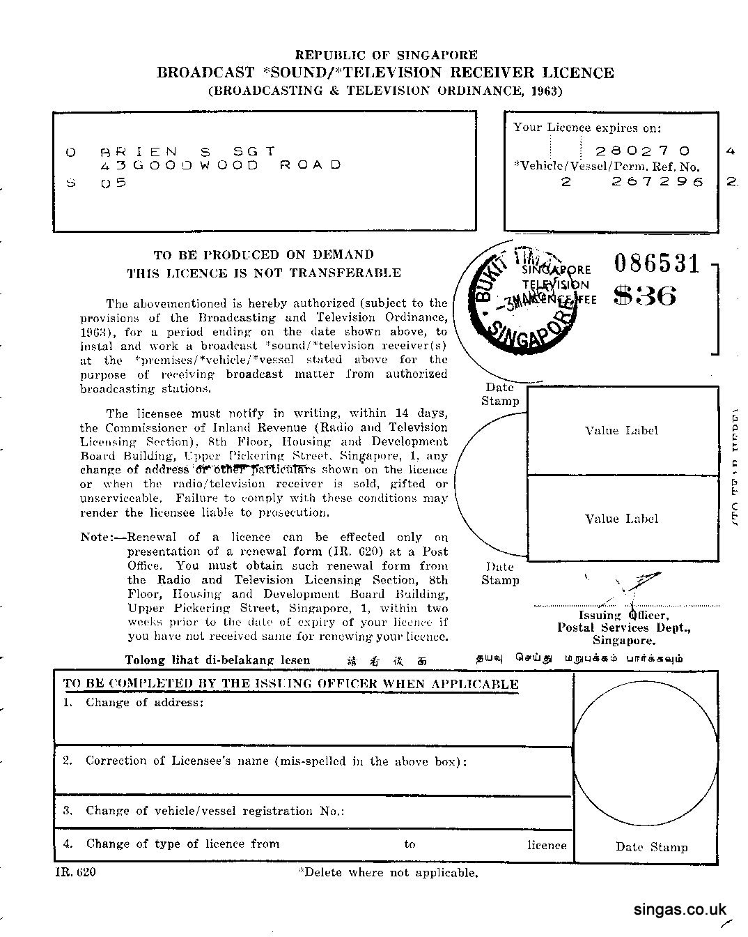
Dulu Punya TV Licence - 1969.

[ Last edited by sutera_abadi at 28-5-2006 11:17 PM ] |
Rate
-
1
View Rating Log
-
|
|
|
|
|
|
|
|
|
|
|
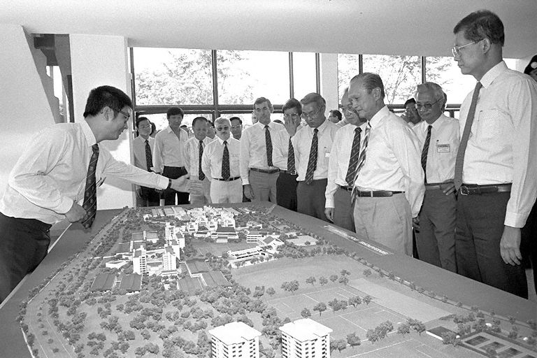
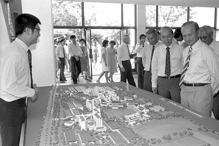
Perancangan pembinaan Poly di Dover Road


[ Last edited by sutera_abadi at 28-5-2006 11:39 PM ] |
|
|
|
|
|
|
|
|
|
|
|
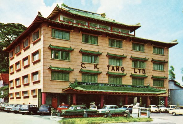
C.K. Tang dulu
 |
|
|
|
|
|
|
|
|
|
| |
Category: Negeri & Negara
|